By BC Staff
Published: January, 2017
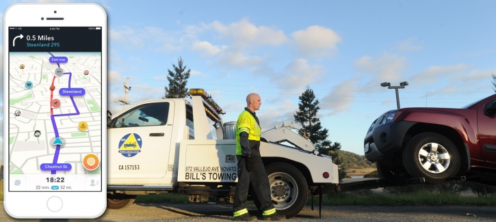
In December, the Metropolitan Transportation Commission (MTC) entered into a data-sharing partnership between its Service Authority for Freeways (SAFE) unit and Waze, the free, real-time crowdsourced navigation app, in which MTC-SAFE’s Bay Area Freeway Service Patrol (FSP) and Waze will share information with each other to provide the public with better traffic and roadway information.
Under this agreement, Waze will share with the Freeway Service Patrol the free, anonymous traffic and incident report data from Waze users (called Wazers). The Bay Area Freeway Service Patrol operates 71 tow trucks that patrol 470 miles of highway during peak congestion periods. FSP drivers stop nearly 7,000 times a month to clear accidents, assist stranded motorists, remove debris, tag abandoned vehicles and otherwise make the region’s freeways safer and less congested.
This real-time information will be used to help FSP tow drivers detect incidents. Waze, in turn, will receive the FSP’s highway incident information — including crashes and stalls — to share with its users. Together, both will have more data and be better able to provide timely assistance to Bay Area drivers.
“We’re happy to help Waze users gain a deeper understanding of real-time conditions,” said MTC Chair Dave Cortese, who also serves as president of the Santa Clara County Board of Supervisors. “FSP incident reports can help more drivers in more places know why congestion has occurred.”
Waze is home to the world’s largest network of drivers who work together daily to outsmart traffic and save time and money. The app consistently recommends the fastest routes based on real-time driving and data from millions of users. From traffic reroutes to low gas price alerts and relevant offers from favorite brands, Waze is one of the most comprehensive driving companions in the marketplace.
The new partnership makes MTC-SAFE the latest of more than 100 public agencies around the world to participate in the Waze Connected Citizens Program, which is designed to promote roadway safety and more efficient travel through the two-way exchange of publicly available traffic information.
The Waze map evolves with every driver and data point it receives, promoting safer roads and sharing more knowledge with Wazers about potential delays. The Connected Citizens Program yields even more data, giving Bay Area travelers a greater ability to circumvent road closures and traffic jams within the app.
“Waze is only as strong as the information it receives from its users and partners,” said Paige Fitzgerald, head of new business development and data acquisition at Waze. “No one knows more about what is happening on the roads than Wazers, and MTC will be able to use these anonymous insights to further promote safer roads. In exchange, MTC is providing critical incident data to Waze, helping Wazers better circumvent major traffic events and real-time traffic blocks.”
To find out more about Connected Citizens, visit www.waze.com/ccp. To download the free Waze app for iOS or Android, visit www.waze.com.


